Chama, NM to Pagosa Springs, CO
June 5, 2019
We took a zero day in Chana yesterday, getting boxes from the post office (thanks Sarah and family and Elaine and Doug for the care packages!!!), and making a delicious dinner of chicken curry in our motel suite.
Today we got breakfast at the diner and planned our plan of attack for entering the San Juan’s via the official CDT (some hikers call it the “high route” because there is an alternate “low route” known as the Great Divide Trail). We’ve talked to a few hikers who have made it through and spent a good portion of time looking at the topos for this section and planning our days and bail out alternates.
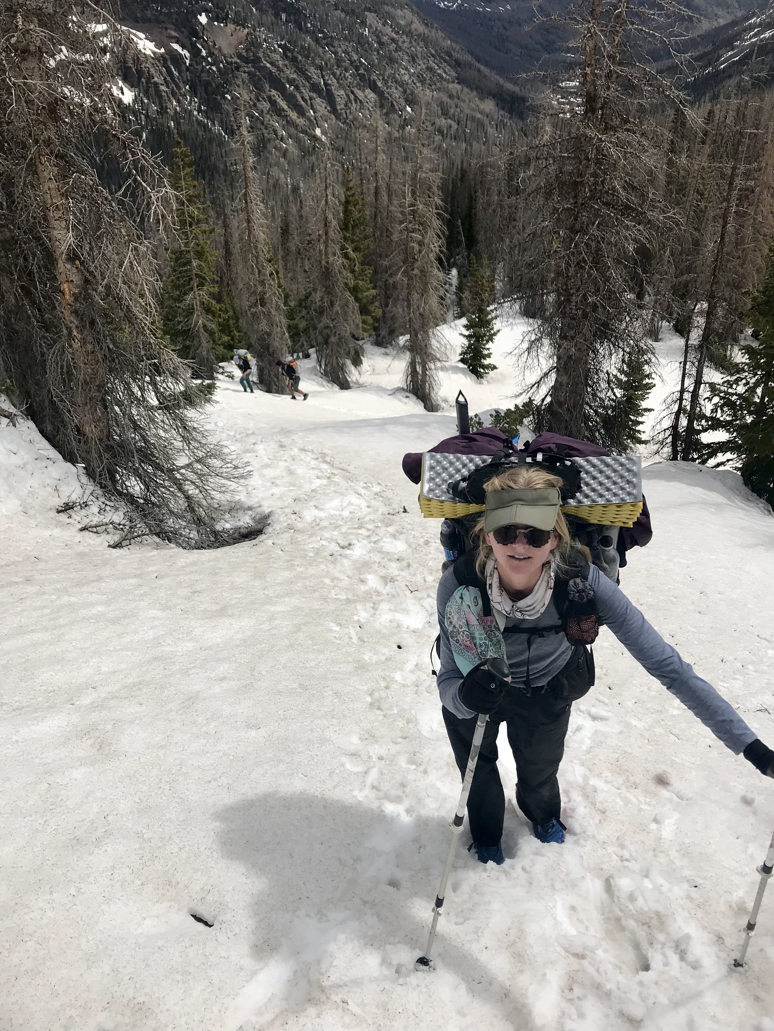
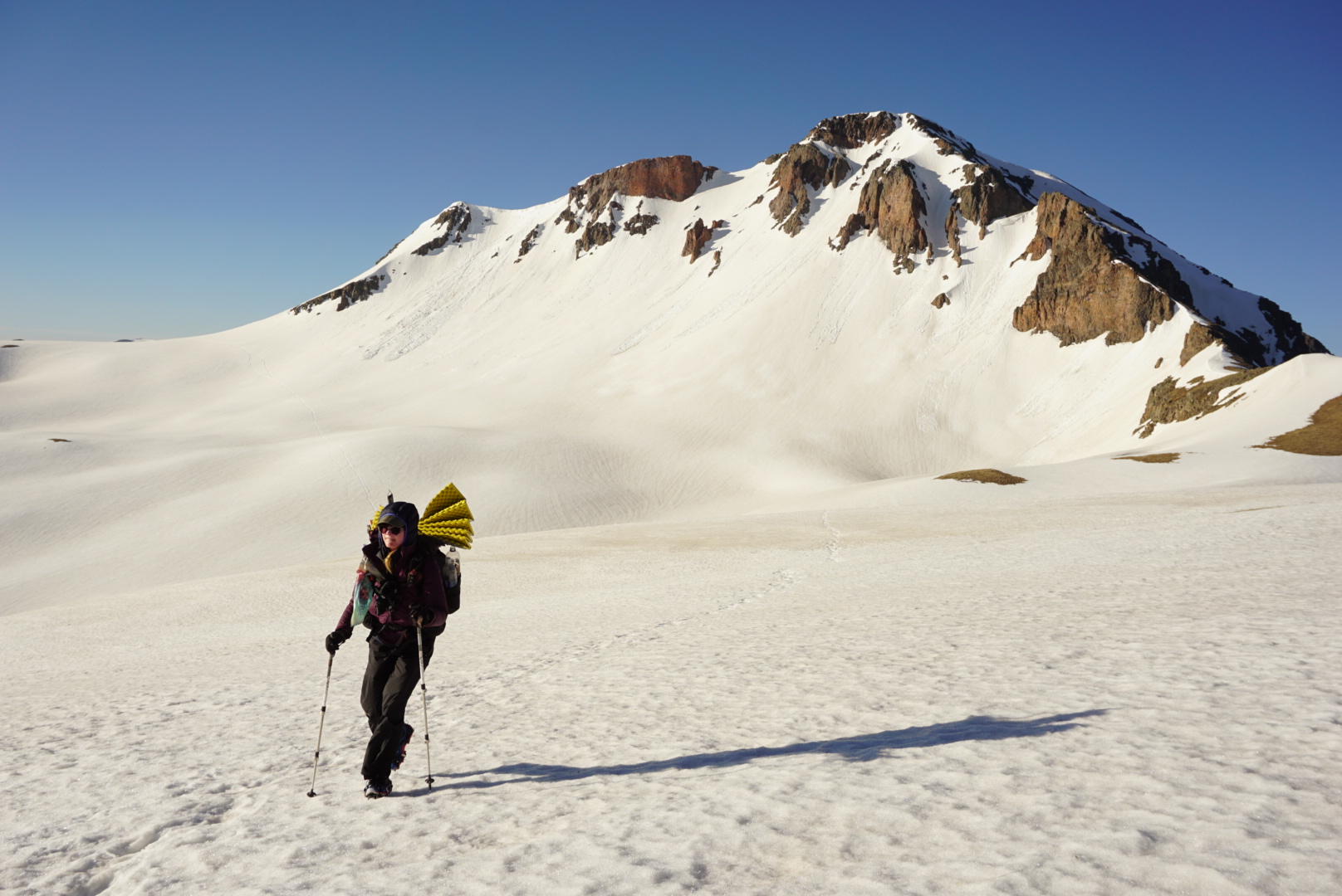
Ralph, a trail angel, drove us and our snow posse (“snosse”) to the trail head. We are entering the San Juans with the usual crew plus Handful, Wing It, and Rango. Two other hikers also started this section with us but they didn’t hike with us. I’ve never seen so many people on the trail before! Talking with Ralph was reassuring. He’s dropped a dozen or so people off who have made it through and “challenging but do-able” seems to be the consensus. Handful and I shared that we felt like our stomachs were at the top of a roller coaster ride during the drive up. I was nervous for sure, especially due to the snow pack, navigational challenges, and avalanche risk. I do feel we are well equipped and very prepared for this section, and the many bail out points are comforting.

We planned to do 5 to 10 miles today but got a late start (after 3:30). We ended up being able to do 8 trail miles (we did a lot of route finding and bush whacking due to snow) and camped in a saddle. It’s interesting seeing people’s approach to snow as we took two different routes to get around some at the end of the day.

The snow was super slushy and I had my first waist-deep post hole. Not bad for hiking in the late afternoon of a hot day.


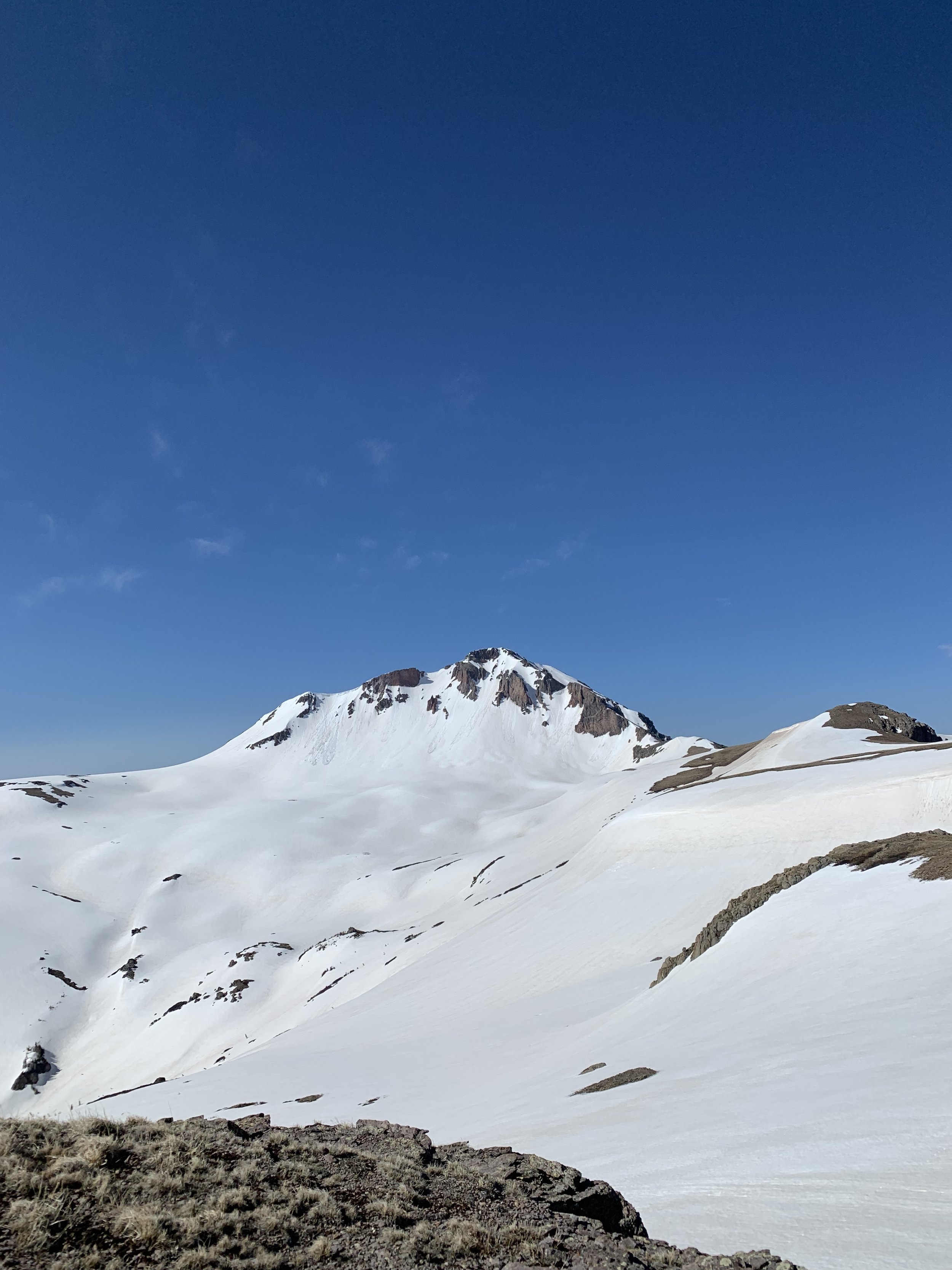
Consulting the topo on the right path to take.


Our campsite today was simply sublime. We settled in all in a great mood from the days adventures. Even though today would likely be the easiest day, we felt pretty confident and lucky to be surrounded by the beauty of the mountains.

June 6, 2019


We woke up early-ish at 5:15 and set off on the trail. The morning was pretty cool as we mostly followed ridges. Looking at the topo, I wasn’t expecting anything dangerous today but I did get a little nervous on one of the ridges and put my crampons on, which helped a lot.


We moved slowly today but not without great effort. Everyone did a great job staying together and we slushed through snow marshes most of the day, post holing constantly. It got really bad after lunch. The sun was so powerfully hot, I don’t think I’ve ever sweat that much on trail, pulling my feet out with every step.

We had a very long day today, getting to our lakeside campsite at 6. Radio and I hacked a hole in the frozen lake with our ice axes to get water for the night. Even though we only did 18 miles, we all agreed it was the hardest 18 mile day we ever had.

Lakeside campsite at Blue Lake - the lake is buried under snow, so we camped on the right side of trees to make sure we weren’t camping on top of the lake.
June 7, 2019
Today got off to a rocky start. Radio, Wonder Woman and I had alarm’s set for 4:30 expecting a 5:15-5:30 start time. However, no one else woke up until we were almost done packing and started waking people up. We ended up leaving at around the same time as yesterday, 6:30, so our early wake up was a waste of time.
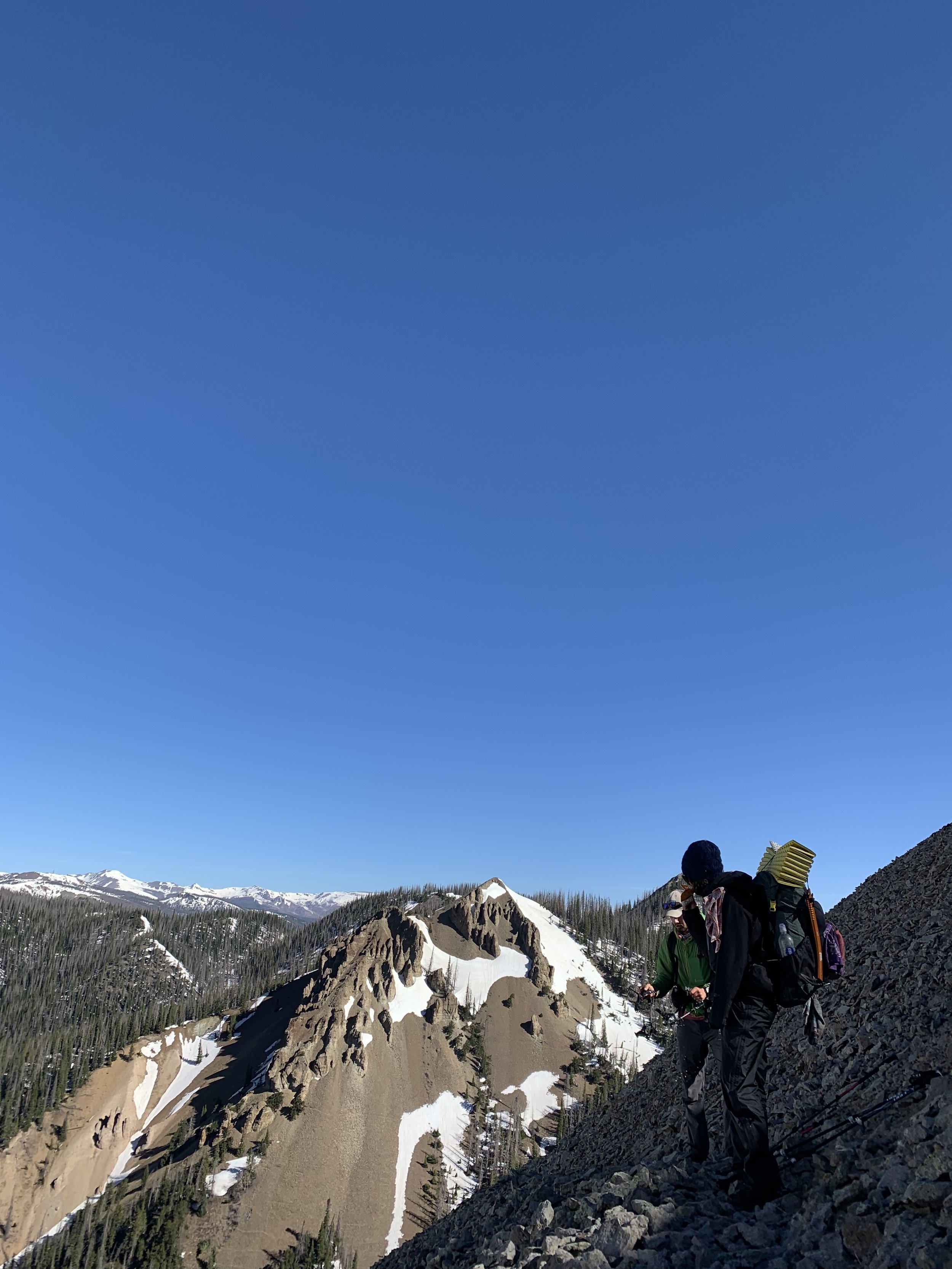
We set off on an alternate route marked on the Ley maps, which routed us down a river and around one of the sketchiest passes on the official CDT. I felt good about this decision as it was a bit shorter and would save us time while being safe!

Descending down to the river.

However, it was a bit of an adventure. And it is always difficult making a route decision in the back country when you have no idea how things will really turn out. The river trail we were following was a swollen waterfall hidden under snow bridges, and crossing it was terrifying. We stuck to weaving between trees on the ridge line down, following the river valley. When we made it to the junction which involved a real river crossing, half our group decided to cut to the Great Divide (the lower route alternate). That left the original crew fending for the CDT. We couldn’t cross at the crossing as the river was fast and deep, and it was only 8:30 in the morning. We walked up and down the river trying to find a place to ford and eventually decided we needed to follow the river towards the Great Divide in hopes of finding a crossing. We walked several miles until we were able to find one that Dan was able to ford. Radio and I forded the river together, and it was by far the most intense river crossing of my hiking career. I used every bit of strength to move my poles and anchor myself before taking another wide step. I was wet up to my shorts. Luckily Radio was there crossing behind me in case anything happened.

Trying to find a place to cross the river.
We made it across safely and I was wrecked. The day was really hard, we hadn’t been following a trail for most of it (trying to find a safe place to cross), and we were so close to the bail out of the lower alternate and a little town. I broke down a bit and almost made the decision to bail out and head to the RV town. Instead, Radio had me drink some water and eat some snacks and I was able to think with a clearer head.
My stomach was still in knots. I’m a cautious person by nature, and it’s hard for me out here to know when to trust my gut and when I’m overreacting. I poured over the maps some more. We really did miss the sketchiest part of the trail, and I couldn’t really identify anything else that at least in terms of contour lines gave me much pause. Also, we would only have 10 miles to do tomorrow until we linked up with Ellwood Pass, another bail out and alternate point. There is also another bail out trail, Treasure Creek, before then, if things are really tough.
I figured I could do ten more miles tomorrow, and made the final decision to head back to the CDT with everyone. After finally crossing the river, we were able to meet up with the North Fork Trail which eventually would connect with the CDT. We had approximately 6 miles left to get back to trail, where the plan was to find somewhere to camp immediately.

Looking towards the official CDT from the Ley alternate across the river.
Right before we connected back with the CDT, we ran into four other hikers who had just come down from the official trail. It was nice to see some other people and they were quite happy to see us.

Not liking the looks of camping in this valley...

Filling up water from a snow drip, halfway up our climb to the campsite.
We continued along the trail and discovered it was following a valley with tremendous avalanche potential looming over us. None of us felt good about camping in that valley, and after a bit we decided to climb up a very steep ridge and get to a dry plateau on top of the ridge (where the hikers we ran into said they were planning to camp). The climb was extremely intense - soft snow, mud, and eventually rocks. I can’t even describe how much adrenaline was pumping through my veins. I don’t know where the strength to keep moving my body upwards came from, but eventually we made it to dry ground and filled bottles from a drip of snow melt (up here, water is all around us - but not a drop to drink). We had one final push to make it to the very top where the plateau would be flat enough to camp on. When we reached the top it was so beautiful tears came to my eyes. I couldn’t stop them from flowing. The scary avalanche monster we were trying to avoid just looked beautiful from across the valley. The sun was hitting everything in a perfect late afternoon light. The one downside was that the ridge was extremely windy. As we all helped set up each others tents, I prayed the wind would eventually settle down. We’ve had bouts of strong wind before when setting up camp, as the change in temperature with the sun setting can have wild effects on the wind, but nothing as strong as this. Regardless, we are all safe and bundled up and ready for tomorrow.


View from our very windy tent site on the plateau.

June 8, 2019


Today felt like two different days and like a very long day combined with yesterday in one.
We woke up at 4:30 and waited for the sun to rise. We were greeted with an amazing sunrise and we crunched our way across a traverse.

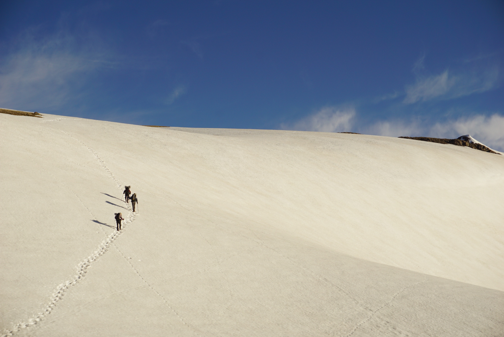
The alpine landscape was beautiful. When we got to the biggest traverse, we saw footprints going up to the top of a ridge, but when we got there we realized there was no way around and there were even a few back track prints. We then decided to downclimb/walk/glissade down to the bottom of the bowl, where we saw footprints coming up. This was the scariest part by far, and looking back at the edge we descended seemed unreal.


Our tracks from the descent.
Climbing down the steep snow slope with our crampons and ice axe was scary but do-able. I was going down last so I decided to start to glissade once I knew the slope had evened out and there was a safe place to stop. Looking back up at what we had just completed was amazing, and we were filled with pride and confidence after navigating that tricky section.


The day soon returned to normal snow slogging as we made our way to Ellwood Pass, where the Great Divide Trail and CDT link up and the option for the Ellwood becomes available. We had planned to meet back up with Handful, Wing It and Rango here, and they had just gotten to the pass as well. We had lunch all together and then made our way back to the CDT.
To avoid a potentially sketchy traverse we climbed to the top of a ridge and then attempted a very steep downclimb. Unknown challenges like this are constant on this trail.
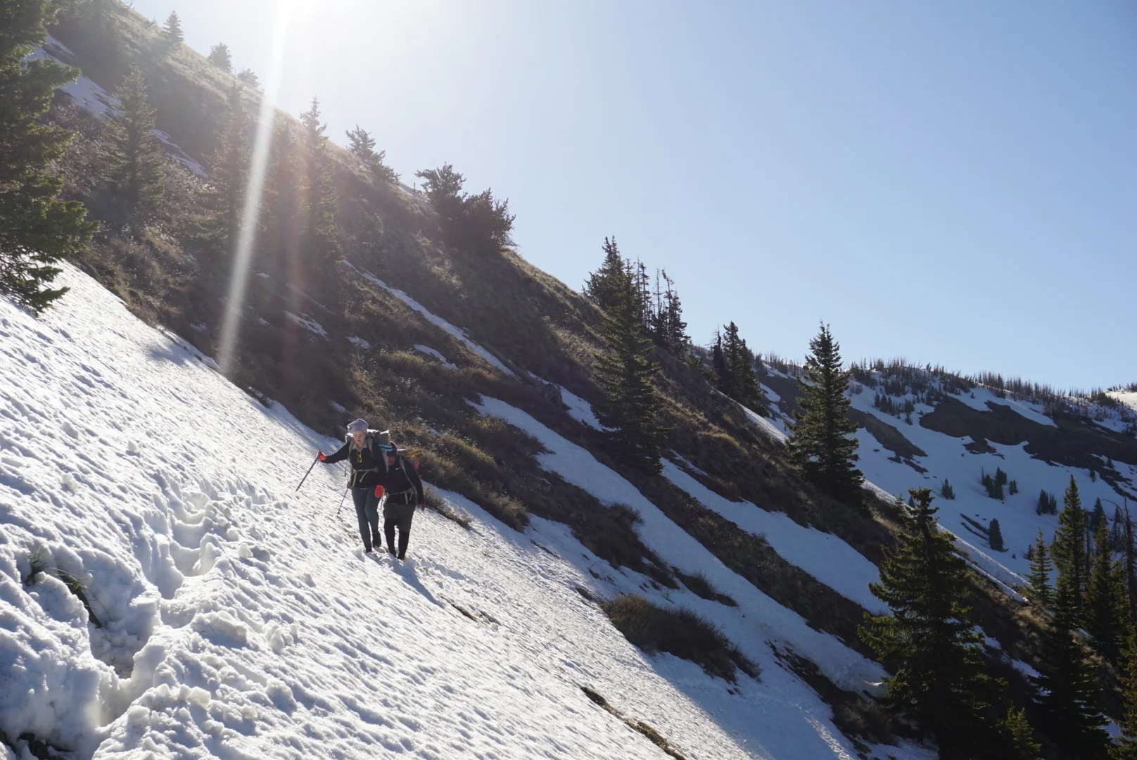
The rest of the day was a total slog through soft, post holing snow. The miles took forever to complete and we ended up stopping just short of our planned campsite as we came across a flat, snowy valley protected by trees. We only did about 14 miles today but it was really hard. We set up snow camp and got ready for the next day.

June 9, 2019
Today we set off on another early start, but I was finally able to get some sleep. I don’t think I’ve ever felt so bone tired in my life. Making terrain decisions and navigating in snow is mentally exhausting, and post holing and trudging through snow is physically exhausting.

Most of the day was traversing like this.
Looking at the topo, we followed ridge lines today but there weren’t any scary peaks or bowls to traverse. However, the reality of the trail with the snow was very different. We traversed through very steep slopes, with various levels of track quality to follow, some times it completely disappeared, or we tried to follow deer tracks. We tried a few times to get to the top of the Divide (the ridgeline) to avoid dangerous traverses, but the constant climbing was exhausting. We ended up staying on the trail most of the day until the end, when the snow was getting soft and dangerous. We hoofed it to the Divide and then identified the start of the Ley route alternate to the pass where we hike to the highway to Pagosa Springs. We all decided to take inspiration from the Ley route, which went around the east side of the reservoir, and just glissade straight down the mountain to the reservoir, which was really fun and a good way to let off some steam and frustration from the day.


Our fun for the day - finding slopes to glissade down!
We came down to the reservoir and decided to go around it the opposite way Ley suggested, which was definitely a mistake, we ended up having to traverse through soft snow and trees above a frozen lake. And when we got there, we had to cross the reservoir. Luckily it wasn’t flowing strongly at all.
We then had a relatively short road walk through a ski resort to the highway, where we tried to get a hitch. The boys got in one van and then me, Rango and Wonder Woman got a hitch from an old RV.
The RV needed time to “breathe” so our driver made a sandwich while he talked to us about how he was driving from Kansas to Pagosa Springs to volunteer at a Habitat for Humanity build. Soon we started the RV up and headed up the pass. We saw Dan and Handful hitching so we pulled over to pick them up. Going down the pass, the power was out in the RV so he was just bombing down the hill with no brakes. Then a cop pulled us over, and he got a ticket for speeding. No bueno. We were a little freaked at this point and wanted to get another ride, but he ended up driving us into town and coming into the brewery for a beer with us. Alls well that ends well, I suppose.